



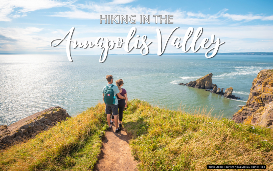
Trail conditions can change seasonally. Always check current conditions before heading out, wear appropriate footwear, and let someone know your plans.
The Annapolis Valley is one of Nova Scotia’s best regions for hiking – not just because of the sheer number of trails, but because of the range. Within a short drive, you can summit sea cliffs above the Bay of Fundy, walk the ocean floor at low tide, meander through old-growth Acadian forest, follow a former railway through apple orchards, or wander the shoreline to a hidden waterfall. Whatever your fitness level or ambition, there’s a trail here for you.
Before venturing out on these Annapolis Valley hiking trails, be sure to have proper clothing (layers are best), hiking shoes or boots, food, and plenty of water. And while you’re on the trails, be tick-aware: stick to the paths, stay out of long grass, and check yourself over when you’re done.
This guide covers the Valley’s best hikes roughly by difficulty, from the most iconic to the most accessible, including a few hidden gems worth knowing about.
The Big Ones: Destination Hikes
Cape Split Loop - Cape Split Provincial Park
Distance: 14.8 km loop | Difficulty: Moderate | Elevation: 634 m | Time: 4–5 hours | Location: Scott’s Bay, near Wolfville
The Cape Split Loop is the hike everyone in the Valley talks about, and it rightly earns the reputation. The trail winds through hardwood and mixed forest along the top of the Blomidon Peninsula before arriving at one of the most dramatic viewpoints in Atlantic Canada: Cape Split itself. This is where the world’s highest tides carve through a narrow gap between towering basalt sea cliffs, 180 metres below. On a clear day, the view stretches across the Minas Basin to Cape Chignecto and beyond.
The route is a 14.8 km loop (a coastal return option was added in 2021), with most of the elevation change at the beginning. It’s manageable for reasonably fit hikers, but earns its moderate rating due to uneven, rooty terrain.
Important things to know:
- Arrive early to best enjoy it! Cape Split draws over 40,000 visitors a year, and the parking lot fills by mid-morning on summer weekends.
- The park is open year-round from dawn to dusk.
- Dogs must be kept on leash, and the cliff edges are genuinely dangerous; stay back from the edge and respect the barriers.
- The trailhead is at the end of Cape Split Road off Route 358, Scott’s Bay.
- The coastal return (making it a loop) is reputed to be a bit more difficult (we have yet to do it ourselves to confirm). Know that if you choose to do it solely as an out-and-back, it is still very worth the effort.
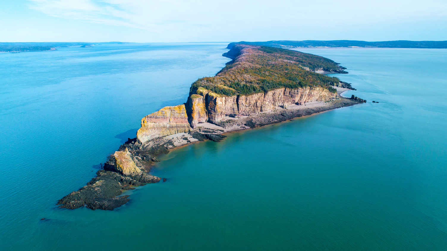
Aerial view of Cape Split. Photo credit: Tourism Nova Scotia / AeroVision Canada Inc.
Jodrey, Woodland and Broden Brook Trail Loop - Blomidon Provincial Park
Total trail system: 11.7 km | Difficulty: Easy to Moderate | Elevation: 402 m | Time: 3-4 hours | Location: Cape Blomidon, near Canning
Blomidon sits atop dramatic 180-metre red sandstone cliffs overlooking the Minas Basin and is one of the most rewarding parks in Nova Scotia for those who want views, variety, and the chance to walk on the ocean floor. The park has four interconnected trails offering everything from a short interpretive stroll to a full half-day loop:
- Jodrey Trail (5.6 km one-way) is the signature route, skirting the cliff edge with multiple lookoffs over the Minas Basin. It’s steep at the start from the lower parking area but levels out considerably once you gain the ridge.
- Borden Brook Trail (3.5 km) climbs through forest to a beautiful waterfall and connects the campground to the lower parking area.
- The Woodland Trail (2.2 km) runs through old-growth Acadian forest and serves as the gentler return leg on the popular full loop.
- The Look-off Trail (1 km loop) branches off at the top for the best panoramic views in the park.
The full Jodrey-Woodland-Borden Brook loop is approximately 12 km and takes 3 to 4 hours. For a shorter outing, park at the campground and do only the upper Jodrey Trail and Look-off; this is about 2 hours round-trip with a stunning payoff.
Important things to know:
- Blomidon is also one of the best spots in the Valley to experience the Bay of Fundy tides firsthand. At low tide, you can walk the exposed red mudflats along the beach, searching for amethysts and agates among the rocks. Check tide tables for “Cape Blomidon” before you go, and plan your beach walk within a few hours of low tide.
- The park is open mid-May through early September for camping (70 sites, no hookups), with the trails accessible year-round for day use.
- Be aware of overgrown sections along the path, and be especially alert for ticks; many have said this is a particularly bad spot for them.
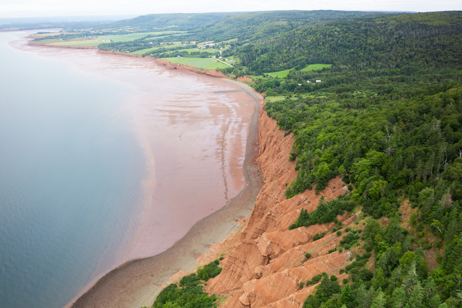
Aerial view of Blomidon Provincial Park. Photo Credit: Tourism Nova Scotia / Branislav Zvada
Coastal Walks and Hidden Waterfalls
McMaster Mills Falls, Greenwood
Distance: 2.6 km | Difficulty: Easy | Time: 30-60 minutes | Elevation: 51 m | Location: Greenwood
McMaster Mills Park is a short, accessible walk on a historic 7-acre property donated to Kings County. Interpretive panels tell the story of the McMaster family and the old mill. The trail leads to a pleasant waterfall along a forest creek. It’s a great option for those staying at the Aurora Inn who want an easy outing close to the hotel.
Crystal Falls Trail - Greenwood
Distance: 3.9 km out-and-back | Difficulty: Easy | Time: 1–1.5 hours | Elevation: 91 m | Location: Greenwood
One of the best-kept local secrets near Kingston and Greenwood, Crystal Falls Trail is a short but rewarding hike through mixed forest to a beautiful waterfall with a swimming hole at its base. The trailhead is accessed via Greenwood Road – park at the road closure sign and walk the dirt road in. At the fork, bear right over the metal suspension bridge and follow the trail down into the ravine; the final descent to the falls is steep, with rope assists in sections, so sturdy footwear is worth wearing even on what’s otherwise an easy outing.
The falls are wonderful, and on a warm day the pool at the base is genuinely inviting, if bracingly cold. The adventurous can cross the water at the bottom and return via the David Morse Trail for a pleasant loop. Dogs welcome on leash. Best visited March through October.
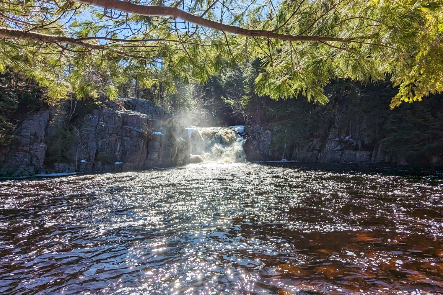
Photo credit: Pete Heck
Margaretsville Waterfall - Margaretsville
Distance: 0.8 km out-and-back | Difficulty: Easy | Time: 30–45 minutes | Location: Margaretsville, Bay of Fundy shore
One of the most unusual waterfall experiences in Nova Scotia, and possibly the only one where the tides play as big a role as the falls themselves. From the wharf in the small village of Margaretsville, a short walk east along a cobble beach brings you to a 15-foot waterfall tumbling directly off the cliff face onto the Bay of Fundy shore; it drops into open water at high tide and onto the exposed seafloor at low tide. The experience is completely different depending on when you arrive, which makes timing your visit around the tides part of the adventure. Note that footing on the cobble beach can be uneven, so sturdy shoes are recommended.
At low tide, you can walk right to the base of the falls, exploring tide pools along the way, and on a clear day see all the way across the Bay to New Brunswick. The Margaretsville Lighthouse (one of the first built on the Nova Scotia side of the Bay of Fundy, dating to 1859) is a short walk from the same parking area, making for a natural pairing. Park at the lot across from the Margaretsville Community Hall to easily visit both.
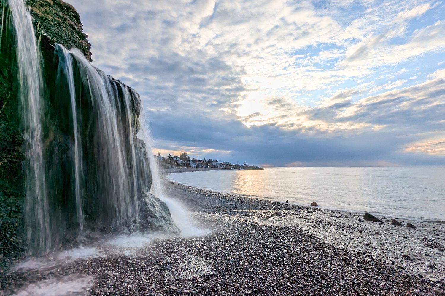
Photo credit: Pete Heck
Shingle Mill Falls - Aylesford
Distance: 0.8 km out and back | Difficulty: Easy | Time: ~30 minutes | Elevation: 13 m | Location: Aylesford Mountain, near Kingston
Tucked on Aylesford Mountain just minutes from Kingston, Shingle Mill Falls is a quick and rewarding outing that most locals know about and most visitors don’t. The falls are easy to reach and are a local favourite. The surrounding woodland is peaceful year-round and is a prime spot for birding.
Delaps Cove and Charlie’s Trail - Delaps Cove
Distance: 8.7 km loop | Difficulty: Easy–Moderate | Time: 2-3 hours | Location: l 24 km from Annapolis Royal
There are two parts to this loop hike: Delaps Cove (2.5 km easy) is a short but spectacular hike along the Bay of Fundy shoreline near Annapolis Royal. The Bohaker Trail meanders through 130 acres of canopied coastal forest before arriving at Bohaker Cove, where a 43-foot waterfall tumbles over the cliff edge onto the rocky shore below. Interpretive signs along the route and a viewing platform at the falls. For those looking for a longer hike, Charlie’s Trail extends the experience by an additional 6 km.
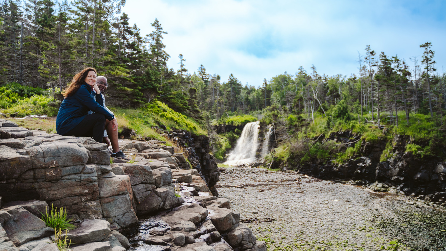
Photo Credit: Tourism Nova Scotia / Rove Production
The Harvest Moon Trailway
Total length: 110 km | Difficulty: Easy | Location: Grand Pré to Annapolis Royal
The Valley’s great walking and cycling corridor – the Harvest Moon Trailway – follows the former Dominion Atlantic Railway bed the full length of the region: from the UNESCO World Heritage Site at Grand Pré all the way to Annapolis Royal, passing through Wolfville, Kentville, Kingston, Middleton, and Bridgetown along the way.
The surface is mostly hard-packed gravel, almost completely flat, and suitable for walkers, cyclists, horse riders, snowshoers, and cross-country skiers in season. It’s a genuinely wonderful way to experience the Valley at a slower pace; the trail passes orchards, farms, wineries, and historic communities, with interpretive kiosks at regular intervals and trailhead access points in most towns.
You don’t need to walk the whole thing. Pick any section that suits your time and energy! The stretch between Wolfville and Kentville is particularly popular, as is the section running along the Annapolis River near Annapolis Royal. Several sections in Kingston, Wolfville, and Kentville are paved, making them stroller- and wheelchair-accessible. Dogs are welcome on leash.

Photo credit: Tourism Nova Scotia / Acorn Art & Photography
More Easy Walks Worth Knowing About
- The Kingston Family Fitness Trail is a popular 1 km walking trail in Stronach Park, and a great place to stretch your legs or simply enjoy a picnic. This walking trail is situated in a small yet diverse forest that is surrounded by wetlands that drain into the Annapolis River. And for the kids, there is the Stronach Park Adventure – Mission Planet Earth, which takes about 1.5 hours to complete.
- A genuine hidden gem in the heart of Kentville, Ravine Trail is a 3.5 km out-and-back trail that winds through one of the last remaining old-growth Hemlock and Pine forests in eastern Canada (a fact that makes it feel far wilder and more remarkable than its modest distance suggests). The trail runs along Elderkin Brook through a cathedral of ancient trees, and is a favourite among walkers, birders, naturalists, and biology researchers. The descent into the ravine is steep and can be slippery (good footwear is recommended), but the valley floor along the brook is easy, peaceful walking. Access is via the Agriculture and Agri-Food Canada Research Station driveway off Highway 1 in Kentville; follow signs to the picnic area at the top of the hill, where the trail begins. Open year-round, dogs welcome on leash. Expect 1 to 1.5 hours to complete.
- Miner’s Marsh is a 1.6 km loop through Ducks Unlimited wetlands in the heart of Kentville, with birdwatching platforms and interpretive signage. One of the best birding spots in the Valley, and a lovely short walk in any season.
- French Basin Trail is a flat, easy 1.9 km trail around a Ducks Unlimited pond in Annapolis Royal. Good for families and a peaceful contrast to the town’s heritage streetscape.
- Breathtaking views of the Annapolis Valley are a highlight of the Valleyview Provincial Park Loop found on the way to Hampton. The hike is an easy 3.1 km loop and is especially gorgeous in the fall with the changing leaves.

Photo credit: Tourism Nova Scotia / Rove Production
Hiking Tips for the Annapolis Valley
- Watch the tides. If you’re hiking near the Bay of Fundy (Blomidon Beach, Delaps Cove, or anywhere along the Fundy shore), check tide tables before you go. The tides rise and fall up to 15 metres and can move faster than you expect. Never hike far from shore when the tide is turning.
- Wear proper footwear. Most Valley trails are forested and uneven, with roots and rocks. Waterproof hiking boots or trail runners are far preferable to sneakers, especially after rain.
- Bring layers. The Bay of Fundy keeps temperatures cooler than the Valley floor, and conditions along cliff edges can change quickly. Even on warm days, pack a windproof layer.
- Trail apps. AllTrails has solid coverage of most Valley trails. Download the maps offline before heading into areas with patchy cell service.
- Seasonal closures. Blomidon’s campground and gated access road close in late fall. The trails themselves remain accessible year-round from the lower beach parking area, but check Nova Scotia Parks for current conditions before visiting in shoulder season.
- Be tick aware. Ticks are especially bad in long grass and off the trails. Wear bug spray, tuck pants into boots, and be sure to check yourself and your pets after your hike.
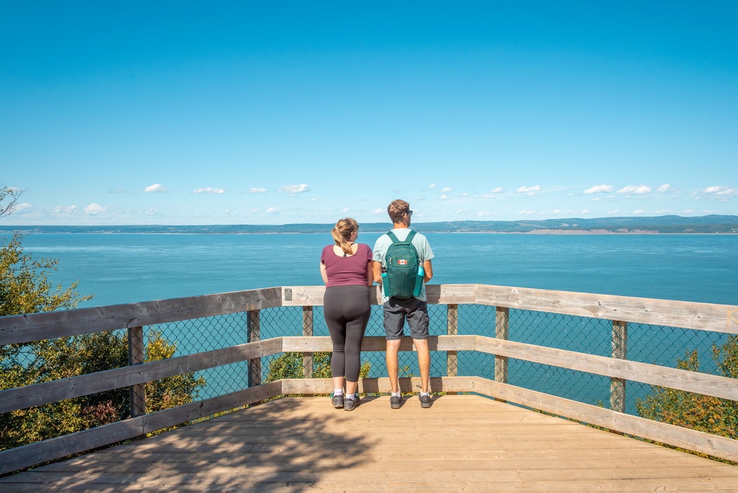
Photo credit: Tourism Nova Scotia / Patrick Rojo
Frequently Asked Questions: Hiking in the Annapolis Valley
What is the best hike in the Annapolis Valley?
Cape Split Provincial Park is the Valley’s most iconic trail – a 13.2 km loop to dramatic sea cliffs overlooking the Bay of Fundy. Nearby Blomidon Provincial Park is a close second, offering more variety across its 13.5 km trail network, including a waterfall, cliff-edge lookoffs, and beach access at low tide.
How hard is the Cape Split hike?
Cape Split is rated moderate. The terrain is uneven with roots and some elevation change, but it’s manageable for most reasonably fit hikers. The total loop is 13.2 km and takes 4 to 5 hours. The reward – a panoramic view from sea cliffs 180 metres above the Bay of Fundy – is worth every step. Arrive early on summer weekends, as the parking lot fills fast.
Are there easy hikes in the Annapolis Valley for beginners or families?
Several. The Harvest Moon Trailway is flat, well-surfaced, and accessible for all ages along its 110 km route from Grand Pré to Annapolis Royal. Miner’s Marsh in Kentville is a short, scenic birdwatching loop. McMaster Mills Falls, near Greenwood, is under a kilometre away. Mickey Hill Provincial Park near Annapolis Royal has a 1 km loop with a suspension bridge that’s great for kids.
Can I hike in the Annapolis Valley year-round?
Yes. Most trails are accessible year-round, though Blomidon Provincial Park’s campground and gated road close in late fall. The Harvest Moon Trailway is also popular for snowshoeing and cross-country skiing in winter. Cape Split is open year-round from dawn to dusk. Check conditions before visiting in spring, as trails can be muddy and some access roads may not be maintained in winter.
Where should I hike near Kingston or Greenwood?
The Harvest Moon Trailway passes right through Kingston and connects to the broader Valley trail system in both directions. Shingle Mill Falls on Aylesford Mountain is a short, easy outing just minutes away. McMaster Mills Falls in Greenwood is another quick local option. For a bigger day, Cape Split and Blomidon are both under an hour’s drive north.
Are dogs allowed on Annapolis Valley hiking trails?
Dogs are welcome on most Valley trails, including Cape Split and the Harvest Moon Trailway, but must be kept on leash. At Cape Split in particular, leash rules are strictly enforced due to the cliff hazards. Always check individual park or trail rules before visiting.
Staying at the Aurora Inn in Kingston? You’re ideally placed for a day of hiking in any direction. Ask at the front desk for local tips.

Sarah is a co-owner of the Aurora Inn. She’s passionate about living in Nova Scotia’s Annapolis Valley and being active in her hometown of Kingston. Apart from running the Aurora Inn, she is also a founder of the Kingston Farmers Market.